-
Model:
Best-selling versions: ADMT-300SX-16D, ADMT-500SX-16D. Other options: ADMT-1200SX-16D, ADMT-2000SX-16D, ADMT-3000SX-16D
-
Features:
16-channel real-time automatic 3D/2D image,10.1" Android touch screen, Multiple measurement modes: MN electrode measurement, TT measurement with box probe
Automatic Imaging: The 10.1-inch Android touchscreen intelligently generates 2D/3D images and curve graphs.
Stable and Accurate: Addresses the inconsistencies and fluctuations in the strength of the natural electromagnetic field, significantly enhancing the accuracy of survey results.
Cross-Device Operation: The instrument, mobile device, and PC can all operate seamlessly using the same backend data.
Smart and Flexible: Channels from 1 to 14 can be selected, with optional electromagnetic probes for TT mode measurements
16-channel Groundwater Detector
R&D Since 1973
Stable Performance High Accuracy

6-Month Trade-Up Guarantee


AI Interpretation

Accurate
& Stable

Auto Imaging

Multi-screen
InterComm
Applications
ADMT ground water detectors are used to find out the location, depth, yield and other related information of groundwater to guide operations of borewell drilling to increase success rate and guide conducting regional hydrogeological investigations.
SEVEN ADVANTAGES
TO HELP YOU EXPLORE WORRY-FREE
High Precision and Strong Anti-interference
 The core module of the instrument adopts integrated packaging, which has high precision and greatly enhanced anti-interference. It is equipped with a high-performance processor to run a variety of algorithms, and the output is stable and accurate, ensuring the accuracy of the instrument in various environments
Auto Plotting
 After the measurement is completed, two-dimensional and three-dimensional color pictures and various curves are generated immediately. It is equipped with a 10.1-inch touch screen and is easy to operate. You can learn to operate it in 5 minutes
High Operation Flexibility
 A variety of adjustable depths,Two interchangable measurement modes, MN and TT
Multi-screen Data Sharing
 To share data on mobile phones, instruments, computers, and remote terminals, you only need to log in with the same account, and data sharing is supported between multiple accounts.
AI-Powered Analysis
 24/7 free AI interpretation of geological images. The system continuously improves based on local user feedback, becoming more accurate with each input, providing reliable recommendations for water exploration and drilling
Free App and value-preserving Upgrade
 The instrument includes a full set of APP software, supports free online upgrades, and can be redeemed for other products within 6 months of purchasefreely
Life time Expert Assistance
 Data processing analysis, instrument maintenance, online technical guidance and other services are all lifetime technical support
GOOD AT CORE AND BEAUTIFUL IN SHAPE

① Hi-Fi Signal Conditioning Amplifier Guaranteed signal accuracy
The analog circuit part of the front-end signal conditioning amplifier of the instrument adopts integrated packaging and shielding, which greatly enhances anti-interference, improves the signal input accuracy, and greatly improves the measurement accuracy of the instrument.
② High performance processor Run multiple algorithms
Adopt high-performance processor, run various algorithms, make the output stable and accurate, and ensure the measurement accuracy of the instrument
③ 10.1 inch touch screen operation
Real-time 2D/3D and curved images

① Handles ② Power Button ③ Charging Port ④ Multi-function Data Port ⑤ Cable Connector
Accessories

① Cable ② Hammer ③ Electrodes x 16
④ Wired connection probe (optional)
Capable of operating on various terrains, including concrete, rock, and frozen soil. It can be operated by a single person.
Product design, packaging, or accessories are subject to change due to ongoing improvements. For the most up-to-date information, please contact our service team.
TECHNICAL PARAMETERS
| Versions | ADMT-300SX-16D | ADMT-500SX-16D | ADMT-1200SX-16D | ADMT-2000SX-16D | ADMT-3000SX-16D |
|---|---|---|---|---|---|
| Max Depth (m) | ≤300 | ≤500 | ≤1200 | ≤2000 | ≤3000 |
| Channel Input | 16 channels of simultaneous input with a standard electrode spacing of 2.5m, and optional spacings of 5m, 7.5m, or 10m | ||||
| Channel Options | 1-14 | ||||
| Depth Options | Optional within the maximum depth, refer to 100/200/300/400/500/600/800/1200/2000/3000m | ||||
| Scan Interval | 10-80 | ||||
| Connections | Serial port, Wifi, Bluetooth 4.0, USB (optional 4G) | ||||
| Display | 10.1-inch IPS wide-angle 178° visual touch screen (1024×600) | ||||
| OS | Android 6.0.1 / Android 13 | ||||
| CPU | ARM Cortex-A7 8-core CPU 2.0Hz / RK3568 | ||||
| GPU | OpenGL ES 2.0 / Mali G52 | ||||
| Core Features | Multiple options of depths, 2D/3D plotting, removable battery | ||||
| Sensing Mode | MN/TT | ||||
| Frequency Range (hz) | 1-8K | 0.01-6K | |||
| Filtering | Preset or intelligent frequency selection, analog + data filtering 1-16 times superposition optional | ||||
| Discrim. | 0.1mV±3% | 0.01mV±2% | |||
| Acquisition Time (s) | 60-3600 | 120-5400 | |||
| Battery | 800mA/H | ||||
| Console Weight | 1.85kg | ||||
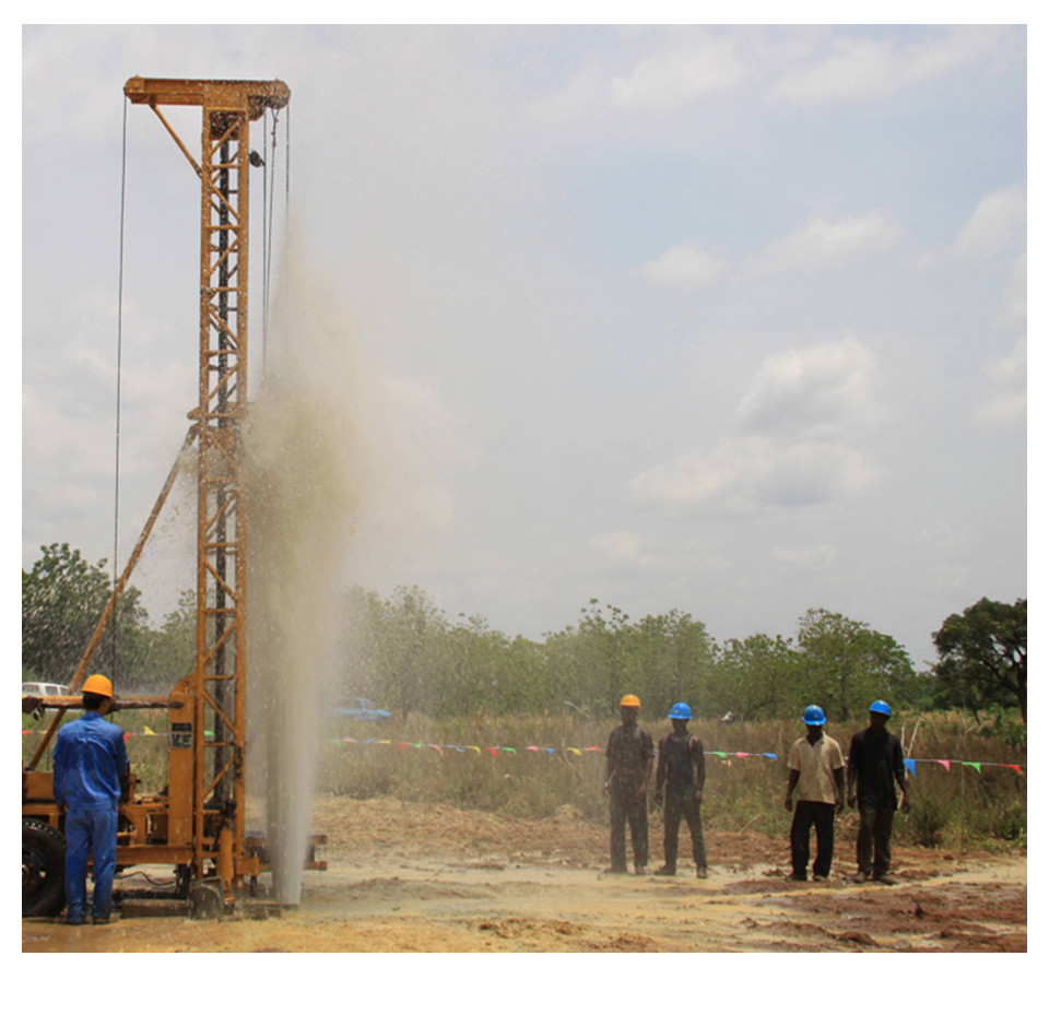
Customer Cases

Site: Liujiaying Village, Zibo, Shandong – Drilling for Water
Product: ADMT Multi-channel Groundwater Detector
Operation: At a depth of around 15 meters, a fracture zone structure is observed. At a depth of 30 meters, a low-resistance anomaly zone appears. Around 50 meters, another fracture zone structure is detected.
Results: Water begins to appear at a depth of 10 meters. The main water-bearing layer is found around 30 meters. At around 60 meters, water volume increases. The total water yield is about 15 cubic meters per hour. Drilling stopped at 83 meters. The actual situation aligns with the imaging results.
Trusted by Millions, CCTV Recommended

SERVING THE WORLD

PROFESSIONAL SERVICE TEAM

QUALIFICATION CERTIFICATE
Certificates and Awards: CE, ISO, China National High-tech Enterprise, China National Technical Invention Patent

R&D Since 1973
1973: Developed the domestic short-wire D75 electrical method
1977: Developed an aerial proton
magnetometer
1981: Developed domestic resistivity DW83 electrical method
1988: Developed a
multi-functional high-power electric method
2001: Developed the NEP series of natural electric field
geophysical probes
2005: Completed the "High-Density Electrical Method" project commissioned
by the Institute of Geology and Geophysics, Chinese Academy of Sciences
2011: Completed the
"Controllable Source Geodetic Electromagnetic Instrument (CSAMT)" project commissioned by the
Institute of Geology and Geophysics, Chinese Academy of Sciences
2013: Received the support of the
Innovation Fund of the Ministry of Science and Technology, and passed the Shanghai High-tech Achievement
Transformation Certification
2017: Developed mobile phone water-finding instrument and geophysical
instrument, supporting two-dimensional and three-dimensional automatic mapping of Android system
2018:
Independent research and development of 16-channel series products to solve the problem of natural electric
field source changes, simple, efficient and precise
2021: Water-finding instrument, geophysical
prospecting instrument, aerial geophysical prospecting, earthquake advanced prediction system, etc. will be
developed for cloud platform big data automatic analysis function
2022: The company was renamed
Shanghai Aidu Intelligent Detection Technology Co. Ltd, and expanded its business operations
2023:
Launched AI automatic analysis functionality, ushering geological exploration into a new era of
intelligence. Introduced speedy water exploration instruments, magnetotelluric instruments, and
high-precision three-component magnetometers
2024: Released an online monitoring system supporting ERT,
bipole electrical, magnetic, and other geophysical data acquisition, with integrated data fusion and
processing capabilities for geological hazard monitoring and prevention
2025: Released UAV magnetic
survey and unmanned boat electrical survey systems with automated acquisition, rapid imaging, cloud-based
inversion processing capabilities


Two-year
Warranty

Lifetime
After-sales

Expert
Support

Free
Upgrade