Groundwater Survey Cases in Australia
Water-finding cases reported by Australian User
Context: To meet the water demand for local agricultural irrigation, the site was surveyed by ADMT Detector in order to obtain a stable groundwater source.
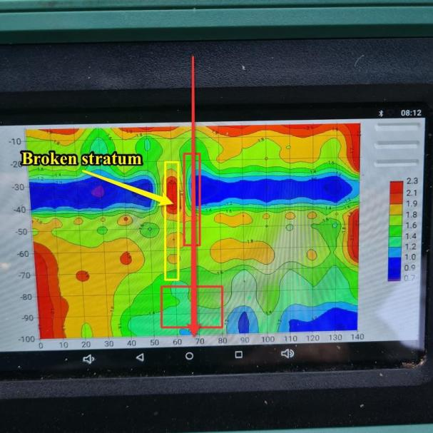
Measurement: ADMT-600SX, TT mode, point distance: 1m, 15 points tested.
Geological data: The local hydrogeological data like strata, lithology are unknown. However, according to the previous drilling data, the strata are mainly composed of granite and metamorphic rocks, with well-developed fractures. In the later image analysis, the focus will be on the location where fracture-water may have developed.

Image analysis: Layered low resistance occurs at a depth of 30-40m. The high resistance in the shape of red bar on the left may be broken rock formation. The probability to get water is higher in the area where the resistivity changes obviously. Therefore, point 70 is selected for drilling. The depth of the aquifer is about 40 meters. We presume that there may be fracture development water under the broken rock layer below 80 meters.

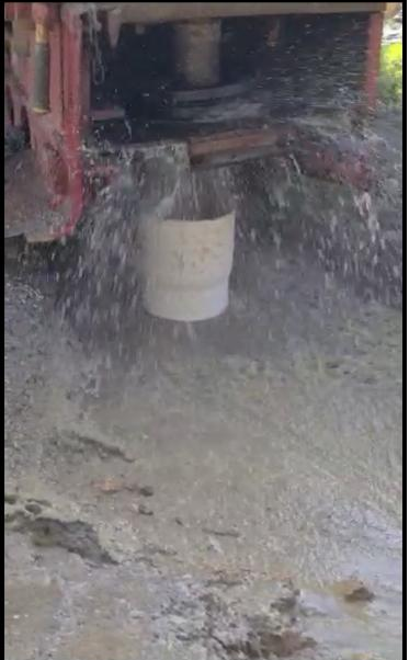
Results: The first 18 meters are regolith. There is water flow at 24 meters, but the amount is not large. A steady flow of water appears at 50 meters with amount of 3 m³ per hour. The final depth is 60 meters and the water amount is 5 m³ per hour.


